
In celebration of Illinois’ bicentennial, Jon McGinty dives into the complex history of “The Prairie State.” Discover how Illinois became central to the U.S. in terms of economy, culture and politics, and learn how you can join in on the celebrations happening through this year.

Illinois entered the Union on Dec. 3, 1818, as the 21st American state, after experiencing a long, tortured history of contested claims for ownership and control.
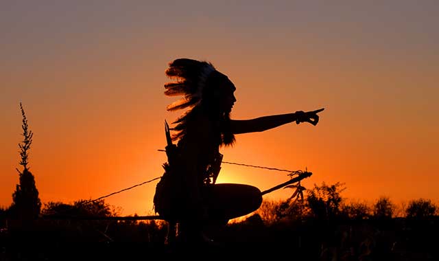
The first inhabitants were nomadic Paleo-Indians who witnessed the retreating glaciers about 12,000 years ago, as they hunted mastodons, wooly mammoths and saber-toothed tigers. Their descendants, the Archaic Indians, built early villages and cultivated seed crops. They were followed by the Woodland Culture, which lasted until approximately 800 AD. The Mississippians appeared around 500 AD, developing complex urban areas and following a tradition of mound-building.
“Monks Mound at Cahokia was the largest prehistoric earthen structure in North America,” says Dr. James E. Davis, author of “Frontier Illinois” and retired professor of history and geography at Illinois College in Jacksonville, Ill. “It covered 14 acres and towered 100 feet. Their mainstay was corn, which appeared in the Illinois Valley by 650 AD. At its peak around 1150, the Cahokia site boasted perhaps 25,000 inhabitants, but by 1400 it was abandoned.”
In the early 1500s, a confederation of Indian tribes called the Illiniwek moved from Michigan to Illinois. Early French explorers used their name to describe a river, and eventually the whole area, as “Illinois.” By 1671, France claimed the Illinois country as part of its colony of New France.
French explorers Father Jacques Joliet and Louis Marquette traversed the region on their way back to Canada in 1673. From the Mississippi River, they followed the Illinois River to the Des Plaines River. They crossed the St. Lawrence divide at the Chicago portage to enter the Chicago River and eventually Lake Michigan. A national historic site commemorates this event at Portage Woods Forest Preserve in Lyons.
When Robert La Salle surveyed the same place in 1680, he recognized its strategic importance as a way to connect the Great Lakes and the Mississippi River.
The French built forts and trading posts in the region, increasing their competition with the British for land and resources, especially furs. This conflict culminated in the French and Indian War, which lasted in North America from 1754 to 1763. Various Indian tribes fought on both sides. France’s defeat forced it to cede Canada and all territories east of the Mississippi, including Illinois, to Great Britain.
“Illinois was a contested place for much of its history,” says Russell Lewis, chief historian and executive vice president of the Chicago Historical Museum. “It was viewed by many as a strategic location, a mid-point between the coasts and adjacent to the Great Lakes and major rivers.”
For the next decade, the British government tried unsuccessfully to prevent East Coast colonists from moving westward. In 1774, the British made Illinois part of Quebec, France’s former colony in Canada, which added to tensions in the Colonies. This erupted a year later as the American Revolution. While most of the fighting took place in the East, in 1778 George Rogers Clark, a militia officer from Virginia, brought the war to Illinois by capturing Kaskaskia, Cahokia and Vincennes. Americans remained in Illinois country for the rest of the war, and by 1783 it was claimed by Virginia.
The Northwest Ordinance of 1787, later replaced by the Ordinance of 1789, created the Northwest Territory (after which this publication is named). It was the first organized territory of the new United States of America and included lands beyond the Appalachian Mountains between British North America and the Great Lakes to the north, the Ohio River to the south, and the upper Mississippi River to the west.
Its more than 200,000 square miles covered the modern states of Ohio, Indiana, Illinois, Michigan and Wisconsin, as well as the northeastern part of Minnesota. It was inhabited by about 45,000 Indians and 4,000 traders, the latter mostly British and Canadians.
“Britain had a much stronger claim to the Northwest Territory than we did,” says Davis, “but we got it. When we were negotiating our independence with Great Britain in 1783, we had a champion on the British side who believed in the message of the first major republic of the Modern Era. He helped us to acquire the whole territory.
“The Ordinance was a remarkable document, and very radical in its results,” he adds. “For the first time in human history, as people expanded across a vast territory, they didn’t create colonies. Rather, they created mechanisms by which people could eventually become citizens of self-governing states – equal to those already existing back East.”
Passage of the Ordinance caused all unsettled lands to be ceded back to the Federal government and established the principle of public domain. It also mandated the future formation of at least three, and not more than five, states from the territory. Ohio became the first state to emerge in 1803, and the remaining area, including Illinois, was named Indiana Territory. Indiana would become a state in 1816, two years before Illinois.
The language of the Northwest Ordinance prohibited slavery in the region but recognized it already existed here. The first slaves were brought to Illinois by the French as early as 1720 to work in the lead mines near Galena and the salt mines in the southeast. Because the Illinois region was settled from south to north, most early settlers came from slave-holding states, although most of them did not own slaves. An indentured servant law allowed some slaveholders to bring slaves under that status, but they couldn’t be bought or sold.
“The Ordinance contained provisions that, in a very roundabout way, would cause slavery to fade away eventually,” says Davis. “What to do with existing slaves became a critical issue as we moved toward statehood.”
In 1809, Illinois was designated a territory, the first step toward statehood.
From 1812 to 1814, Americans battled the British and their Indian allies for trade rights and territorial control in the War of 1812. That war included the massacre at Fort Dearborn near Chicago, Perry’s conquest of the British Fleet on Lake Erie, and the Indians’ defeat in Ontario, where Tecumseh was killed. Black Hawk, chief of the Sac tribe, fought on the British side and was forever known as the leader of the British Band.
“Three individuals, all from Kentucky and all related, played important roles in the move toward statehood,” says Lewis. “Ninian Edwards became the first territorial governor; his cousin, Nathaniel Pope, was the territorial secretary and a strong advocate for statehood; and his nephew, Daniel Pope Cook, after whom Cook County was named, played a central role in the process and became Illinois’ first state attorney general.”

In December 1817, the territorial legislature approved a resolution for Illinois to become a free state, one that forbids slavery. A Constitutional Convention was held in August 1818 to hammer out the details, and Kaskaskia was chosen as our first capitol.
“Illinois entered the Union under a cloud of perceived necessity to balance free and slave states as they joined,” says Davis. “This was especially important to Southern states, since each state was allowed two senators, regardless of population. They demanded this ‘compromise’ as a way to protect their ‘way of life,’ which depended to a considerable degree on the institution of slavery.
“In 1824, Illinois citizens held a referendum to approve slavery in the state, but it was rejected sharply,” Davis adds. “Thus, Illinois escaped the last effort to make it a slave state.”
The Northwest Ordinance also stipulated that the northern boundaries of what became Ohio, Indiana and Illinois should be even with the southernmost tip of Lake Michigan. But when Ohio became a state in 1803, it pushed its boundary six miles north.
“This disappointed Michigan greatly, since they lost some territory, including the city of Toledo,” says Davis. “Later, they got the Upper Peninsula as a kind of consolation prize, which disappointed residents in Wisconsin. Indiana became a state in 1816, and they pushed the boundary even farther north to gain more Lake Michigan coastline.”
Congressional delegate Nathaniel Pope was inspired by Ohio and Indiana to convince Congress to push the Illinois border 51 miles north of the lake’s southern terminus. This added more than 3 million acres – 8,000 square miles – to the state, which includes the 10 northernmost counties and parts of four more. It also included the Galena lead mines, the Rock River Valley, what became the city of Chicago, and the route ultimately chosen to build the Illinois & Michigan Canal, which opened in 1848 and connected the Illinois River to the Great Lakes.

“Had Pope and others not launched this drive, Illinois would have been a radically different state, much more Southern in outlook than it was,” says Davis.
In his book, “Rockford: Big Town, Little City,” Pat Cunningham suggests Illinois might have become a slave state as a result, and the Civil War might have transpired in different ways. Since these northern counties were mostly inhabited by people from New York and New England, their attitudes differed greatly from settlers in the southern part of the state.
As a result, secessionism raised its ugly head in 1842, when several northern counties, including Winnebago County, passed non-binding referendums to leave Illinois and join Wisconsin. But when Wisconsin entered the Union in 1848, the boundary remained where it had been for the past 30 years.
There was also a problem with residence requirements as stipulated in the Ordinance. It required territories to have at least 60,000 residents to become a state, but the number could be reduced under certain circumstances. Pope got the federal government to reduce the required number for Illinois to 40,000.
“In early 1818, there may have been about 34,000 people in the Illinois Territory,” says Davis. “No one knows for sure.”
Advocates for statehood convinced the government that territory officials could do the counting, not the feds.
“They counted people passing through the territory, some more than once,” says Davis. “Maybe 600 were counted in Wisconsin. The ‘official’ count was 40,258. We became the smallest state in population ever admitted to the Union, and we achieved it by ‘creative counting.’”
Chicago became an official town in 1837, and by 1848, the Illinois & Michigan Canal was completed. It ran 96 miles from Chicago’s Bridgeport neighborhood to the Illinois River at La Salle-Peru, connecting the Mississippi River to the Great Lakes – as La Salle, Pope and others had predicted.
By opening up connections to eastern markets, the canal made Midwest agriculture profitable, which in turn created the booming city of Chicago.
“Between 1830 and 1890, Chicago was the fastest-growing city in the world,” says Lewis. “Its population increased by 37 times, and it surpassed Philadelphia in 1890 to become the country’s second-largest city, behind New York City. It was also the largest city in the world in area.”
“Illinois is the keystone state for everything east of the Rockies,” says Davis. “It is connected to the East Coast by way of the Great Lakes and the St. Lawrence River and to the Gulf Coast by the Mississippi River. For many years, it was the launching pad for going West, up the Missouri River and out to the Great Plains and beyond [including the Lewis and Clark Voyage of Discovery]. It is still central to the U.S., in terms of economy, culture and politics. We reflect a lot of the country. More than any other state, Illinois is THE all-American state.”
Happy Birthday, Illinois!